Wolsingham Wayfarers
More than just a Walking Group...
Registered Charity No: 1070219
Wolsingham Wayfarers
Wolsingham Wayfarers are a registered charity looking after and promoting the 140 miles of Public Rights of Way in the parish of Wolsingham & Thornley in Weardale, County Durham. Our mission is to promote walking for both health and social benefits, while encouraging visitors to visit and explore our beautiful town.
Our Mission
Get Walking
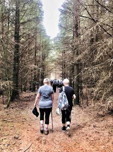
We organise free monthly guided walks and have produced a series of free self-guided walk maps. Our aim is to inspire individuals to embrace walking, reaping the social and health benefits, while supporting our community and local businesses.


Wolsingham is an accredited Walkers Are Welcome Town
Walking for well-being
Join us to explore the beautiful Wolsingham scenery whilst enhancing your physical and mental well-being through social walking.


Community Engagement
Volunteering with Wolsingham Wayfarers is a great way to contribute to the local community, from rolling up your sleeves helping to replace a waymarker post, to taking an active part on the Charity's Committee. If you would like further details of available volunteering opportunities with Wolsingham Wayfarers, please contact us HERE.
Subscribe
Subscribe to our Newsletter to receive regular news by email including monthly walk details and general Wayfaring updates. Click HERE to subscribe.

Subscribe to our Newsletter
Receive all the latest Wolsingham Wayfarers news, including guided walk details, direct to your inbox.
Contact Us


Don't be shy... contact us to learn how you can help, to find out more about our walk and maintenance programmes, ...or anything else walking related.
Connect
wolsinghamwayfarers@gmail.com
© 2024. All rights reserved.
Wolsingham Wayfarers is a registered charity. Registered in the UK. Registration number: 1070219